
Walk a Slidell Street by Address
No single public roll lists every person at every Slidell home. The strongest street-by-street method begins with the address and preserves the date and role shown by each source. The St. Tammany Parish Assessor connects a physical site to an assessment record. Its GIS connects that record to a parcel shape. The Clerk of Court then supplies recorded instruments and maps, while voter and historical sources can add dated evidence of residence. This Slidell street directory workflow separates verified facts from reasonable inferences.
- Normalize the number, directional, suffix, unit, city, and ZIP. Try common variants such as Street and St. if the first query fails.
- Run the physical address through the Assessor assessment search. Save the assessment year, owner string, property description, and assessment number.
- Open the same parcel in the official GIS viewer. Compare its outline and legal description with the text record.
- Use the current owner and legal description in the Clerk's land index. Follow each grantor and grantee, the parties transferring and receiving land, to recorded instruments.
- For occupancy clues, use the official voter address route or a dated directory, newspaper, or census record. State exactly what each record shows.
The chain is address to parcel, parcel to owner, owner to deed, and then date-specific household evidence. If the street label changes, the subdivision, lot, square, ward, or map reference may keep the chain intact.
Normalize Slidell Street Search Terms
Small differences can hide a valid Slidell result. Keep the house number apart from the street name, directional, suffix, apartment or lot, city, and ZIP. The Assessor specifically advises trying variants such as Highway and Hwy. A postal label is useful for delivery, but it does not prove that a parcel lies inside Slidell city limits. When no street match appears, search the subdivision, lot, square, property description, or assessment number.
Older records may identify a ward, bayou, plat, or metes-and-bounds description instead of a modern number. Metes and bounds describes land through measured courses and boundary calls. Record the address exactly as each source prints it. That makes a later spelling or jurisdiction difference visible instead of silently blending two sites.
Note: A clean USPS result confirms delivery wording, not ownership, occupancy, parcel boundaries, or legal municipality.
Slidell Street Directory Search Fields
The Assessor confirms more search routes than the current text-only form reveals. The live page exposes an assessment year, assessment number, and search type, while JavaScript supplies other controls. The official FAQ confirms owner, physical address, mailing address, care-of, property description, and year searches. The screenshot from the Assessor's assessment instructions shows the official starting point.
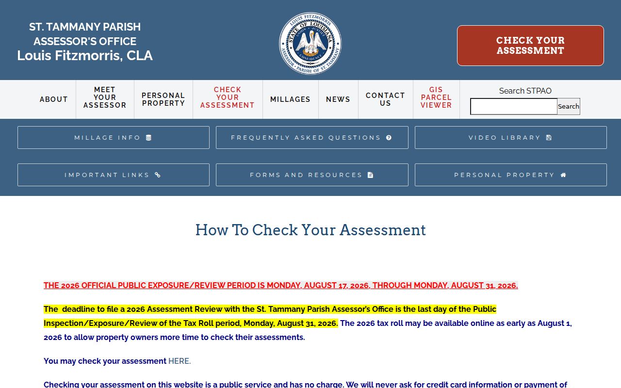
Use the field that best matches the known fact, then retain both the chosen roll year and the exact result. This keeps the street directory tied to a dated assessment rather than an undated owner claim.
| Search field | Status | What to save |
|---|---|---|
| Assessment number | Number-only route, no punctuation | Exact number, year, result, legal description |
| Owner name | Confirmed by Assessor FAQ | Name variants and displayed status |
| Physical or situs address | Confirmed search option | Number, suffix, city, ZIP, parcel |
| Mailing address or care-of | Separate search options | Keep apart from the physical site |
| Property description | Confirmed search option | Subdivision, lot, square, ward |
| Assessment year | Selector | Year and roll status |
Slidell Mailing and Situs Addresses
A situs address means the physical location of a parcel. The mailing address is where tax notices go, and it can be elsewhere. The Assessor's closing guidance says the deed appearance clause controls the desired mailing address for tax bills. A care-of line can add another name without showing who occupies the Slidell property.
The official property-search field guidance helps distinguish those routes before a query is run.
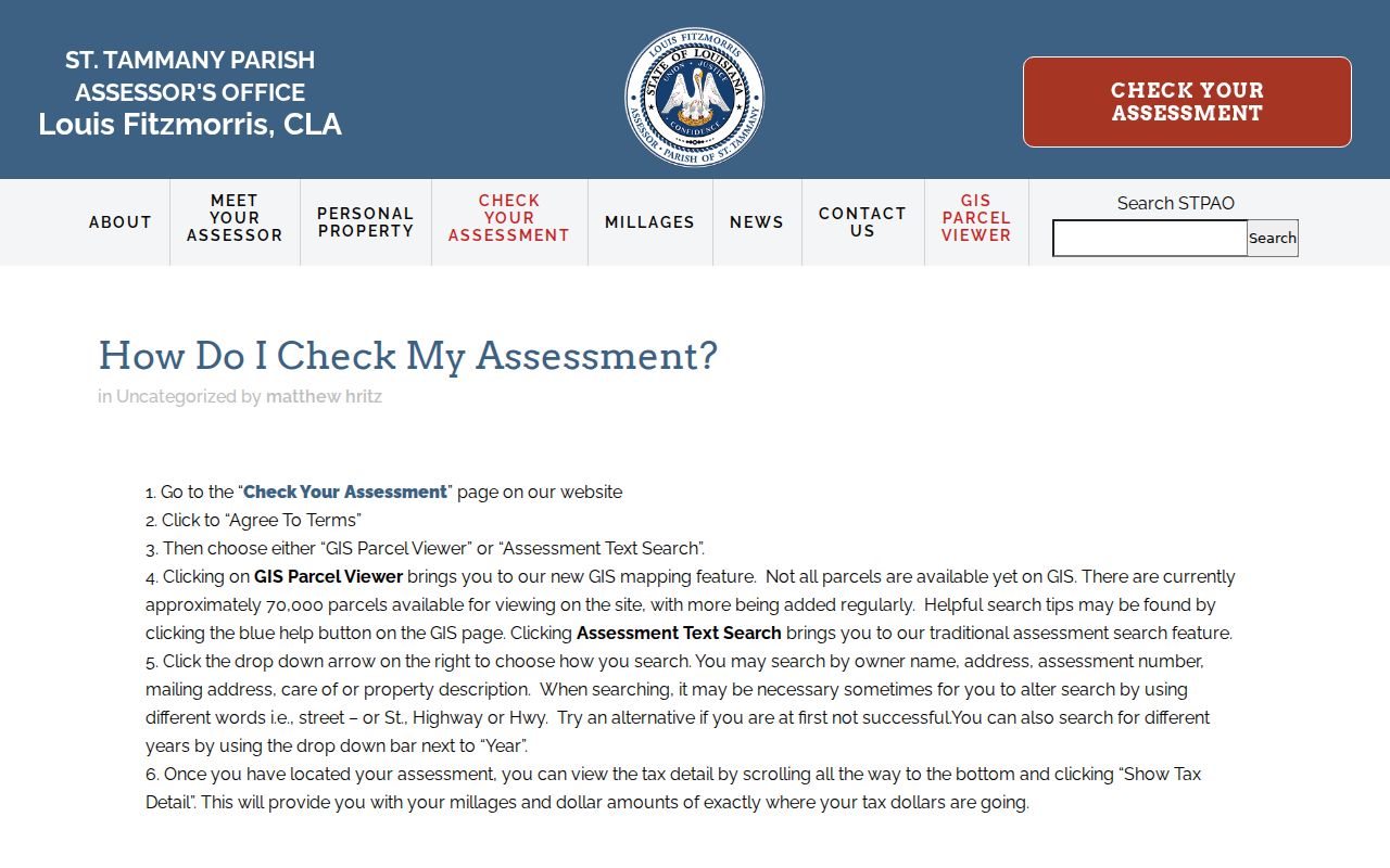
Label each address by role in the research notes. Never turn a tax-mail destination into the parcel address or treat either field as proof of a current resident.
Map Slidell Streets in GIS
The Assessor GIS adds shape and position to a Slidell street directory search. Its documented tools include Layers, Identify, Search, Buffer, Measure, Print, and Search History. Start with a known assessment number, identify the parcel, and compare its legal description to the assessment card. Parcel outlines and nearby polygons can reveal that a road, waterway, or common tract breaks what looked like a simple row of lots.
GIS is spatial evidence, not a deed certification. Save the map date, scale, active layers, parcel number, and the exact fields returned by Identify. The parish mapping project reported more than 134,000 ownership parcels mapped by April 2025, but that project count is not a promise that every boundary or label is current.
- Parcel
- A legally described piece of land represented by an assessment record and map polygon.
- Situs address
- The physical location assigned to the property, distinct from its tax-mail destination.
- Plat
- A recorded map that identifies lots, squares, roads, and other subdivision features.
- Criss-cross directory
- A directory arranged by street or address rather than only by a person's surname.
Slidell Records Keyed by Street
Each address source answers a different question. The street directory becomes reliable only when the keeper, date, access route, and limits travel with the fact. Online access is convenient, but the Slidell Annex, Covington counters, Archives, mail requests, and reference librarians remain essential fallbacks.
| Record Set | Keeper | What It Shows | Access |
|---|---|---|---|
| Assessment roll | St. Tammany Parish Assessor | Owner, situs, mailing address, description, year | Online, Slidell Towers, Covington office |
| GIS parcel map | St. Tammany Parish Assessor | Parcel geometry, layers, adjacent parcels | Free viewer and office help |
| Deeds and maps | St. Tammany Parish Clerk | Parties, instruments, legal descriptions, plats | Cott, legacy transition, counter, mail, Archives |
| Voter address route | Louisiana Secretary of State | Current registration result as exposed | Portal; purchased file is separate |
| Planning files | City of Slidell | Applications, permits, zoning, dated address roles | Published packets or records request |
| Historical sources | Library, Archives, repositories | Dated names, addresses, notices, footprints | Catalog, databases, librarian, in person, mail |
The assessment number and legal description bridge the roll, GIS, recorded map, and deed. A standardized street address bridges city files, voter searches, and historical material, but it should never replace the parcel identifiers when the two disagree.
Follow Slidell Streets Into Deeds
The St. Tammany Recording Department records conveyances, mortgages, maps, cash sales, partitions, judgments, and other immovable-property instruments. Its official department view establishes the custodian behind the land evidence.
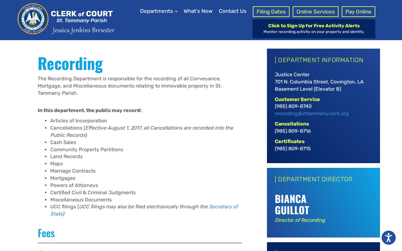
Cott Record Hub became the current gateway on July 27, 2026, while the older land portal remains available through December 31, 2026. Legacy guidance places conveyance and mortgage book data from July 1, 1961 forward, images from 1977 forward, and maps from 1810 forward. Those ranges differ. An index hit does not promise an online image.
Search the owner as a grantee to find the purchase, then read the grantor, legal description, recording date, instrument or book and page, and map reference. If online access stops, use the Slidell Annex for many land services, the Covington Recording counter, phone or email, mail, or Archives. Ask by record series and date, not for every record tied to an address.
Slidell Planning Files by Address
City zoning and planning packets can connect a dated Slidell address to an applicant, parcel, proposed work, dimensions, plat, survey, contractor role, permit, or certificate. They supplement the parish street directory chain because they describe a municipal action at a stated time. A name in a packet may be an applicant or professional, not an owner or resident.
The city's historic-resource survey lists 230 buildings in a 2021 document. That list can add a building identifier and survey date. For unpublished permits, complaints, or certificates, identify the exact address, record type, and date range in a request under the Louisiana Public Records Law. Preserve the response or no-record statement with the query.
Slidell Streets Across Time
The seven-sheet March 1926 Sanborn set can show street lines, cross streets, building footprints, and use labels. It answers a different question than today's GIS parcel and a recorded deed. The Sanborn image dates a built environment, GIS maps current parcel geometry, and the deed documents a legal transfer. Their agreement is useful; their differences are evidence too.
Historical directories, newspapers, and census schedules add names, but an exact Slidell criss-cross run was not verified in the public library catalog. Ask St. Tammany Parish Library reference staff for reverse directories, street sections, yearbooks, maps, vertical files, and house-history aids. Search the St. Tammany Farmer, Slidell Sentry, and regional newspapers with street variants and dates.
The full historical shelf belongs on the Slidell city directory page. Here, each dated entry serves as one checkpoint in an address chain.
Note: A directory or newspaper mention supports a dated association, not continuous occupancy or a complete household.
Rank Slidell Street Evidence
When sources conflict, rank them by the fact being tested. A recorded instrument or certified Clerk copy is strongest for a transfer and legal description. A dated Assessor record paired with GIS is strong for an assessment and mapped parcel. A city permit proves the listed municipal action, while a voter result or historical entry proves only the role, date, and fields it displays.
- Start with the recorded instrument for title events.
- Pair the assessment record with its roll year and GIS parcel.
- Add city planning or historic files tied to the address and date.
- Use voter, directory, newspaper, or census evidence for dated personal associations.
- Use USPS only to normalize delivery wording.
A good working line records the address string, source, role, date, jurisdiction, instrument or page, confidence, and caveat. That compact record prevents a weak postal or directory clue from outranking the deed.
Limits of a Slidell Street Directory
An assessment owner is not necessarily an occupant. A deed party may have transferred an interest without living at the site. Voter data is subject to state restrictions and confidentiality, and the free portal is not the same as the separately purchased voter file. Protected addresses, sealed records, and nonpublic personal data should remain unavailable.
No result can mean a variant address, an older legal description, a record outside the online coverage period, an unindexed filing, or a lawful restriction. Move from the portal to the proper counter, Archives, mail request, library, or city custodian before concluding that the record does not exist.
Lawful use. Use Slidell address records only for lawful personal research, such as property history or family history. Never use them to stalk, harass, intimidate, or harm anyone.